
In order to address forest degradation and consequential severe weather conditions witnessed in the Himalayan State of Uttarakhand (india), Japan International Cooperation Agency (JICA) supported Uttarakhand Forest Resource Management Project (UFRMP) is under implementation.
As Technology Partners, SPARC has assisted UFRMP to restore about 37,500 ha of degraded forests involving 800+ Van Panchayats (community forest organizations) across the state over the past 6 years.
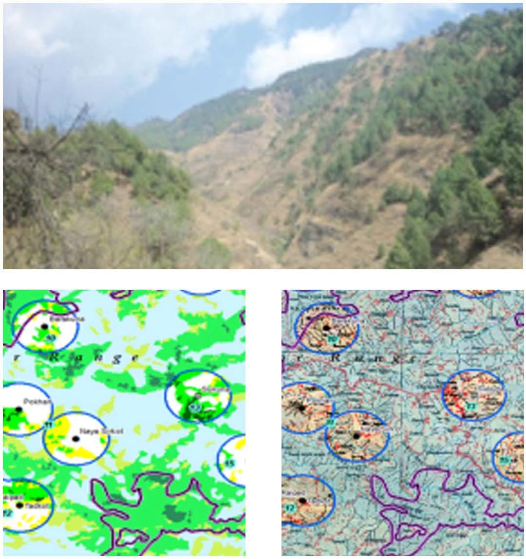
Extent of forest degradation in the vicinity of each Van Panchayat (VP) was analyzed from Remote Sensing data. Prioritization and selection of the VPs were made based on extent of forest degradation, beneficiary population, feasibility of cluster formation with degraded areas surrounding adjoining VPs, other on-going interventions; followed by field validation.
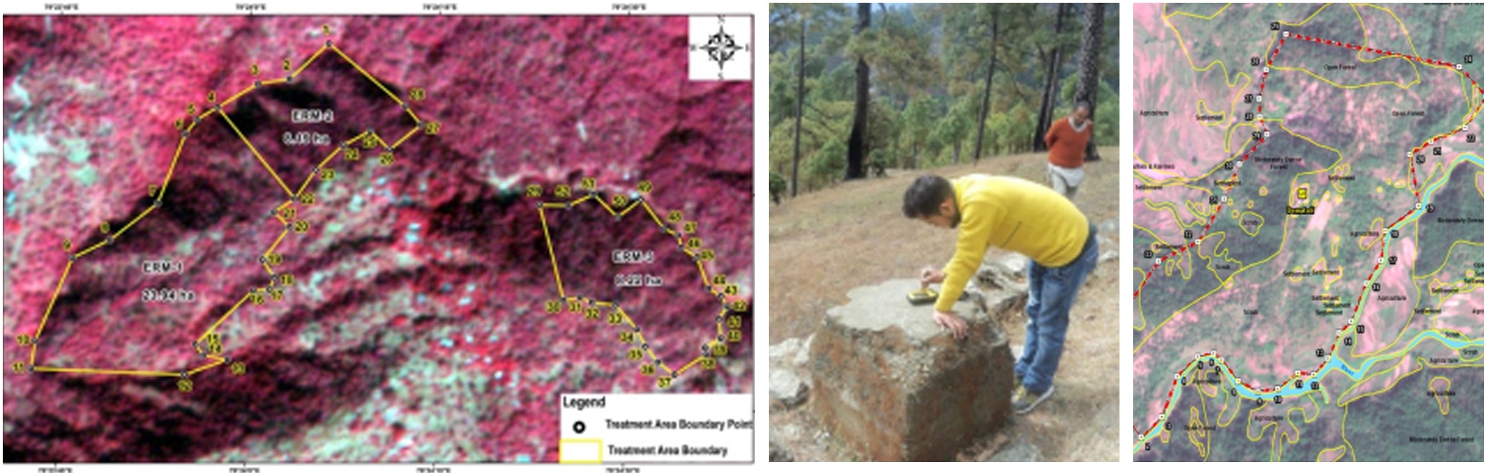
Intervention areas (degraded areas), assigned to each VP, were precisely demarcated on ground by DGPS survey and baseline vegetation data such as vegetation type, age-class, route stock, soil conditions, were collected through an App. Insights on elevation, slope and aspect of each intervention area were ascertained through GIS studies. These inputs were used to prepare area wise eco-restoration micro-plans detailing ANR (Assisted Natural Regeneration), SMC (Soil Moisture Conservation) and Planation activities.
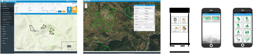
A customized tech-platform as a WebGIS based Monitoring-Reporting-Verification (MRV) was designed, developed and implemented by SPARC to collect gee-tagged photographs with key attributes of different eco-restoration activities using a Mobile app and push it
to the cloud server. After due validation by forest officials,
the data were used to certify the works and fund utilization in the project, maintaining transparency among all the stakeholders. The system also helped Forest Carbon certification of these community managed forest areas and helped them earn Carbon Credits.
SPARC's technology expertise has played a pivotal role in restoring degraded forests, with active participation of Van Panchayats (community forest organizations) across the state. Through meticulous analysis of remote sensing data, prioritization of intervention areas, and precise demarcation using advanced surveying techniques, SPARC has facilitated the formulation of eco-restoration micro-plans tailored to the needs of the community. By enabling real-time data collection, validation, and certification of eco-restoration activities, we were able to ensure transparency and accountability among stakeholders. The ability of earning carbon credits has further motivated local communities to preserve and monitor the forests.
The successful implementation of UFMRP was our pioneering effort to look at the transformative potential of GIS technology in sustainable forest management. Through continued collaboration and innovation, we can further enhance environmental resilience and contribute to the well-being of communities in Uttarakhand and beyond.